History Of Faridkot
Faridkot (Punjabi: ਫ਼ਰੀਦਕੋਟ; Hindi: फ़रीदकोट)
Faridkot is a small city and a municipal council in Faridkot district in the state of Punjab, India.It's a division with headquarter at Faridkot consists of three Districts Faridkot, Bathinda and Mansa. There are 8 Sub Divisions, 8 Tehsils and 9 Sub-Tehsils within these Districts.Total area of the District is 1475.70 Sq. K.M.
Prior to independence large part of the district was under the princely rule of Maharaja of Faridkot and later it became part of the Patiala & East Punjab States Union (PEPSU ) in 1948. Faridkot was carved out as a separate district on 7 August 1972 out of the areas of Bathinda District (Faridkot Tehsil) and Firozpur District (Moga and Muktsar Tehsils). However in November 1995, the Faridkot District was trifurcated when two of its sub divisions viz Muktsar and Moga were given the status of independent districts.
Etymology :
It has been named after the great Sufi Saint Baba Sheik Fariduddin Ganjshakar, whose verses are mentioned in Guru Granth Sahib the holy book of Sikh religion.In 13th century,this town was founded by Raja Mokalsi, the grandson of Rai Munj, a Bhatti Chief of Rajasthan and named Mokalhar after his name. A famous Sufi Saint Hazrat Baba Sheikh Farid happened to pass through this town during the same time. Baba Farid was captured by the soldiers of Raja Mokalsi and put to bonded labour for the ongoing construction work of the fort at Faridkot. The basket full of earth while being carried by Baba Farid was seen floating over his head. On seeing this miracle, Raja touched the feet of Baba Farid and begged pardon. Baba Farid pardoned the Raja and meditated at a place near the fort, where he penanced for forty days. From that day the name of Mokalhar was changed to Faridkot.The place, where he stayed, is still called, ‘Tilla Baba Farid’, and ‘Baba Sheikh Farid Aagman Purb Mela’ is celebrated each year in the month of September, commemorating his arrival in the city.
The main crops of the city are wheat, paddy and cotton. Industries of the town include cotton handling, from ginning to baling, as well as manufacture of machine tools, sewing machines.
History :
Faridkot State The history of the Faridkot District pertaining to the ancient period has been traced to the Indus Valley Civilization. A few sites explored in the Moga Tehsil(Now a separate District) link it with Indus Valley Civilization sites explored in the Rupnagar District. A vast area, including the present area of Faridkot District was under the influence of Indus Valley Civilization.
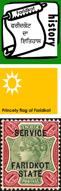
Princely flag of Faridkot The ruling dynasty of Faridkot State claimed descent from Rawal Jaisal, who founded Jaisalmer in Rajasthan in 1156. The town was founded in the 16th century by his descendant Bhallan of the Burai Jats.The ancestor of the Faridkot principality, Bhallan was an ardent follower of 6th Sikh Guru Har Gobind. He helped the Guru Har Gobind ji in the battle of Mehraj. He died issueless in 1643. Kapura, who was a nephew of Bhallan, succeeded him. Kapura founded the town of Kotkapura in 1661. Nawab Kapura was the Chaudhry of eighty-four villages. He was a Sikh but did not want to earn the ire of the Mughals and help Guru Gobind Singh Ji and fight with Mughals. The famous last battle of Muktsar (Khidrane Di Dhaab) now a historic town, happened after Nawab Kapura declined Guru Gobind Singh's request to use his fort to fight Mughal Army. Otherwise the last war between Mughals and Guru Gobind Singh Ji was destined to happen at Kotkapura. Guru ji moved from Kotkapura to Dhilwan Kalan from there to Talwandi sabo via Guru ki Dhab. However, later in the battle of Muktsar in 1705, Nawab Kapuray, helped Guru Gobind Singh Ji in an underhand manner. Kapura was slain by Isa Khan Manj in 1708. He had three sons named Sukhia, Sema and Mukhia. Mukhia killed Isa Khan and took control of the entire area. Sema was also killed in this battle in 1710. Kapura’s elder son Sukhia again came into power in 1720.
Faridkot State Stamp A dispute between grandsons of Kapura (sons of Sukhia) led to the division of the state in 1763. The older brother, Sardar Jodh Singh Brar, retained control of Kotkapura, and his younger brother, Sardar Hamir Singh Brar, was given Faridkot.
The state was captured in 1803 by Ranjit Singh, but was one of the Cis-Sutlej states that came under British influence after the 1809 Treaty of Amritsar. During the Sikh wars in 1845, Raja Pahar Singh aided the British, and was rewarded with an increase of territory. The state had an area of and its 642 square miles (1,660 km2), and a population of 124,912 in 1901. It was bounded on the west and northeast by the British district of Ferozepore, and on the south by the state of Nabha. The last Ruler of Faridkot was Lt. HH Farzand-i-sadaat Nishan Hazrat-i-kaisar-i-hind Raja Sir Harindar Singh Brar Bans Bahadur. Before partition there was majority Muslim population in Faridkot. There are many mosques in Faridkot which are taken care of by Sikh villagers.
Faridkot has played a leading role in the politics of the state of Punjab with a number of chief ministers and even a president hailing from the area. Although the separation of Moga and Muktsar left this district considerably smaller, the area remains an important political arena.
Geography :
Faridkot is located at 30°24′N 74°27′E / 30.40°N 74.45°E / 30.40; 74.45. It has an average elevation of 196 metres (643 ft).It lies in south west of the state and is surrounded by Ferozepur District in the north west, Moga and Ludhiana Districts in the north east and districts of Bathinda and Sangrur in the south.It has two Sub divisions/ Tehsils namely Faridkot and Jaito and two Sub Tehsils namely Kotkapura and Sadiq comprising a total of 171 villages. Faridkot District has two development blocks namely Faridkot and Kotkapura.
The topography of the district is plain, with only 1.4% of its area under forest cover. There are no rivers or natural drains flowing through the district. There is, however, a vast network of canals flowing through the district. Sirhind Canal system has been taking care of the irrigation and drinking water needs of the District since a long time.
Climate :
It is located on the Punjab Plain which in a macro regional context forms a part of great Satluj Ganga plain. It is a low lying flat area. The surface of the district is depositional plain which was formed by alleviation by the rivers in the remote past. No river is flowing through the district, butthere are some drains which flow during heavy rains and serve as natural drainage. There is a vastnetwork of canals i.e.Bikaner, Sirhind feeder and Rajasthan Canal passes through district Faridkot.Sirhind feeder, Rajasthan Canal and Abohar Branch of Sirhind canal run through the entire length ofdistrict in north-south and northeast-southwest directions respectively. Sirhind Canal system hasbeen serving the district for irrigation since long times.The climate of the Faridkot District is mainly dry, characterized by a very hot summer, a short rainy season and a bracing winter. The year may be divided into four seasons. The cold season is from November to March. This is followed by the summer season which lasts up to about the end of June. The period from July to the middle of September constitutes the southwest monsoon season. The later half of September and October is the post-monsoon or transition period. There is no meteorological observatory in the district. The Temperatures increase ra.pidly beginning with the end of March till June, which is generally the hottest month, with the mean daily minimum temperature about 41 degree celtius and the mean daily minimum about 26.5 degree celtius. It is intensely hot during the summer, and the dustladen winds which blow, especially in the sandy parts, are very trying. The maximum temperature may go beyond 47 degree celtius on individual days. With the onset of the monsoon by about the end of June or early July, there is an appreciable drop in the day temperature. However, during breaks in the monsoon during latter part of July and in August the weather becomes oppressive due to increase in day temperatures. By about the second week of September, when the monsoon withdraws from the district, both day and night temperatures begin to decrease. The fall in the night temperatures even in October is much more than that in the day temperatures. After October both the day and night temperatures decrease rapidly till January which is the coldest month. The mean daily maximum temperatures in January is about 20 degree celtius and the mean daily minimum about 4.5 degree celtius. In the cold season the district is affected by cold waves in the wake of passing western disturbances and the minimum temperature occasionally drops down to about a degree or two below the freezing point of water. The average annual rainfall in the district is 433 mm. about 71 percent of the annual rainfall in the district is received during the monsoon months July to September, July/August being the rainiest months. Some rainfall occurs during the pre-monsoon months, mostly in the form of thundershowers and in the cold season. Skies are moderately clouded during the monsoon season and for short spells of a day or two during cold season in association with the passing western disturbances. During the rest of the year the skies are mostly clear or lightly clouded. Winds are generally light in the district, and are northerly to northwesterly, at times southeasterly, throughout the year. But, during the summer and monsoon seasons winds from directions between north-east and south-east blow on many days. Thunderstorms and more frequently duststorms occur during the hot season. Rain during the monsoon season is also sometimes accompanied with thunder. Fog occurs occasionally in the cold season.
Demographics :
As of 2011[update] India census,[5] Faridkot has a population of 618,008 which constitute about 2% of the total population of Punjab. Males constitute 327,121 of the population and females 290,887.The population density in this district is 424 persons per sq. km. Faridkot has an average literacy rate of 70.6%: male literacy is 75.9%, and female literacy is 64.8%. 79% of the population follows Sikhism and 21% follows Hinduism.There are also a few families of muslims living here in perfect harmony,based on the rich values of brotherhood left by sikh Gurus and baba Farid.
Faridkot is a small city and a municipal council in Faridkot district in the state of Punjab, India.It's a division with headquarter at Faridkot consists of three Districts Faridkot, Bathinda and Mansa. There are 8 Sub Divisions, 8 Tehsils and 9 Sub-Tehsils within these Districts.Total area of the District is 1475.70 Sq. K.M.
Prior to independence large part of the district was under the princely rule of Maharaja of Faridkot and later it became part of the Patiala & East Punjab States Union (PEPSU ) in 1948. Faridkot was carved out as a separate district on 7 August 1972 out of the areas of Bathinda District (Faridkot Tehsil) and Firozpur District (Moga and Muktsar Tehsils). However in November 1995, the Faridkot District was trifurcated when two of its sub divisions viz Muktsar and Moga were given the status of independent districts.
Etymology :
It has been named after the great Sufi Saint Baba Sheik Fariduddin Ganjshakar, whose verses are mentioned in Guru Granth Sahib the holy book of Sikh religion.In 13th century,this town was founded by Raja Mokalsi, the grandson of Rai Munj, a Bhatti Chief of Rajasthan and named Mokalhar after his name. A famous Sufi Saint Hazrat Baba Sheikh Farid happened to pass through this town during the same time. Baba Farid was captured by the soldiers of Raja Mokalsi and put to bonded labour for the ongoing construction work of the fort at Faridkot. The basket full of earth while being carried by Baba Farid was seen floating over his head. On seeing this miracle, Raja touched the feet of Baba Farid and begged pardon. Baba Farid pardoned the Raja and meditated at a place near the fort, where he penanced for forty days. From that day the name of Mokalhar was changed to Faridkot.The place, where he stayed, is still called, ‘Tilla Baba Farid’, and ‘Baba Sheikh Farid Aagman Purb Mela’ is celebrated each year in the month of September, commemorating his arrival in the city.
The main crops of the city are wheat, paddy and cotton. Industries of the town include cotton handling, from ginning to baling, as well as manufacture of machine tools, sewing machines.
History :
Faridkot State The history of the Faridkot District pertaining to the ancient period has been traced to the Indus Valley Civilization. A few sites explored in the Moga Tehsil(Now a separate District) link it with Indus Valley Civilization sites explored in the Rupnagar District. A vast area, including the present area of Faridkot District was under the influence of Indus Valley Civilization.
Princely flag of Faridkot The ruling dynasty of Faridkot State claimed descent from Rawal Jaisal, who founded Jaisalmer in Rajasthan in 1156. The town was founded in the 16th century by his descendant Bhallan of the Burai Jats.The ancestor of the Faridkot principality, Bhallan was an ardent follower of 6th Sikh Guru Har Gobind. He helped the Guru Har Gobind ji in the battle of Mehraj. He died issueless in 1643. Kapura, who was a nephew of Bhallan, succeeded him. Kapura founded the town of Kotkapura in 1661. Nawab Kapura was the Chaudhry of eighty-four villages. He was a Sikh but did not want to earn the ire of the Mughals and help Guru Gobind Singh Ji and fight with Mughals. The famous last battle of Muktsar (Khidrane Di Dhaab) now a historic town, happened after Nawab Kapura declined Guru Gobind Singh's request to use his fort to fight Mughal Army. Otherwise the last war between Mughals and Guru Gobind Singh Ji was destined to happen at Kotkapura. Guru ji moved from Kotkapura to Dhilwan Kalan from there to Talwandi sabo via Guru ki Dhab. However, later in the battle of Muktsar in 1705, Nawab Kapuray, helped Guru Gobind Singh Ji in an underhand manner. Kapura was slain by Isa Khan Manj in 1708. He had three sons named Sukhia, Sema and Mukhia. Mukhia killed Isa Khan and took control of the entire area. Sema was also killed in this battle in 1710. Kapura’s elder son Sukhia again came into power in 1720.
Faridkot State Stamp A dispute between grandsons of Kapura (sons of Sukhia) led to the division of the state in 1763. The older brother, Sardar Jodh Singh Brar, retained control of Kotkapura, and his younger brother, Sardar Hamir Singh Brar, was given Faridkot.
The state was captured in 1803 by Ranjit Singh, but was one of the Cis-Sutlej states that came under British influence after the 1809 Treaty of Amritsar. During the Sikh wars in 1845, Raja Pahar Singh aided the British, and was rewarded with an increase of territory. The state had an area of and its 642 square miles (1,660 km2), and a population of 124,912 in 1901. It was bounded on the west and northeast by the British district of Ferozepore, and on the south by the state of Nabha. The last Ruler of Faridkot was Lt. HH Farzand-i-sadaat Nishan Hazrat-i-kaisar-i-hind Raja Sir Harindar Singh Brar Bans Bahadur. Before partition there was majority Muslim population in Faridkot. There are many mosques in Faridkot which are taken care of by Sikh villagers.
Faridkot has played a leading role in the politics of the state of Punjab with a number of chief ministers and even a president hailing from the area. Although the separation of Moga and Muktsar left this district considerably smaller, the area remains an important political arena.
Geography :
Faridkot is located at 30°24′N 74°27′E / 30.40°N 74.45°E / 30.40; 74.45. It has an average elevation of 196 metres (643 ft).It lies in south west of the state and is surrounded by Ferozepur District in the north west, Moga and Ludhiana Districts in the north east and districts of Bathinda and Sangrur in the south.It has two Sub divisions/ Tehsils namely Faridkot and Jaito and two Sub Tehsils namely Kotkapura and Sadiq comprising a total of 171 villages. Faridkot District has two development blocks namely Faridkot and Kotkapura.
The topography of the district is plain, with only 1.4% of its area under forest cover. There are no rivers or natural drains flowing through the district. There is, however, a vast network of canals flowing through the district. Sirhind Canal system has been taking care of the irrigation and drinking water needs of the District since a long time.
Climate :
It is located on the Punjab Plain which in a macro regional context forms a part of great Satluj Ganga plain. It is a low lying flat area. The surface of the district is depositional plain which was formed by alleviation by the rivers in the remote past. No river is flowing through the district, butthere are some drains which flow during heavy rains and serve as natural drainage. There is a vastnetwork of canals i.e.Bikaner, Sirhind feeder and Rajasthan Canal passes through district Faridkot.Sirhind feeder, Rajasthan Canal and Abohar Branch of Sirhind canal run through the entire length ofdistrict in north-south and northeast-southwest directions respectively. Sirhind Canal system hasbeen serving the district for irrigation since long times.The climate of the Faridkot District is mainly dry, characterized by a very hot summer, a short rainy season and a bracing winter. The year may be divided into four seasons. The cold season is from November to March. This is followed by the summer season which lasts up to about the end of June. The period from July to the middle of September constitutes the southwest monsoon season. The later half of September and October is the post-monsoon or transition period. There is no meteorological observatory in the district. The Temperatures increase ra.pidly beginning with the end of March till June, which is generally the hottest month, with the mean daily minimum temperature about 41 degree celtius and the mean daily minimum about 26.5 degree celtius. It is intensely hot during the summer, and the dustladen winds which blow, especially in the sandy parts, are very trying. The maximum temperature may go beyond 47 degree celtius on individual days. With the onset of the monsoon by about the end of June or early July, there is an appreciable drop in the day temperature. However, during breaks in the monsoon during latter part of July and in August the weather becomes oppressive due to increase in day temperatures. By about the second week of September, when the monsoon withdraws from the district, both day and night temperatures begin to decrease. The fall in the night temperatures even in October is much more than that in the day temperatures. After October both the day and night temperatures decrease rapidly till January which is the coldest month. The mean daily maximum temperatures in January is about 20 degree celtius and the mean daily minimum about 4.5 degree celtius. In the cold season the district is affected by cold waves in the wake of passing western disturbances and the minimum temperature occasionally drops down to about a degree or two below the freezing point of water. The average annual rainfall in the district is 433 mm. about 71 percent of the annual rainfall in the district is received during the monsoon months July to September, July/August being the rainiest months. Some rainfall occurs during the pre-monsoon months, mostly in the form of thundershowers and in the cold season. Skies are moderately clouded during the monsoon season and for short spells of a day or two during cold season in association with the passing western disturbances. During the rest of the year the skies are mostly clear or lightly clouded. Winds are generally light in the district, and are northerly to northwesterly, at times southeasterly, throughout the year. But, during the summer and monsoon seasons winds from directions between north-east and south-east blow on many days. Thunderstorms and more frequently duststorms occur during the hot season. Rain during the monsoon season is also sometimes accompanied with thunder. Fog occurs occasionally in the cold season.
Demographics :
As of 2011[update] India census,[5] Faridkot has a population of 618,008 which constitute about 2% of the total population of Punjab. Males constitute 327,121 of the population and females 290,887.The population density in this district is 424 persons per sq. km. Faridkot has an average literacy rate of 70.6%: male literacy is 75.9%, and female literacy is 64.8%. 79% of the population follows Sikhism and 21% follows Hinduism.There are also a few families of muslims living here in perfect harmony,based on the rich values of brotherhood left by sikh Gurus and baba Farid.
